Showing posts with label Fortification. Show all posts

Friday, July 10, 2015

Diyarbakir (Amida), AD 502-503

AD 502-503
The second siege of Amida came almost 150 years later. That century and a half had largely been a peaceful one. The Persians seemed satisfied with the new territory gained after Julian's death and contented themselves with only interfering in Armenia. This new found peace was aided by a series of crises that affected the Persian empire. This time it was their turn to come under barbarian attack, and a series of monarchs were defeated by the Hephthalites who invaded the eastern regions of the empire from their territory in modern Afghanistan and Pakistan.

The most disastrous campaign was that of Peroz. Defeated in one encounter he was forced to leave his young son Kavad as hostage with the Hephthalite king. Unwilling to let this humiliation go he broke his oath and returned to Hephthalite territory where at Herat he was tricked into leading a cavalry charge across concealed pits and killed along with most of his army. His son Balash was able to piece together a new government in Ctesiphon, but this brought him into conflict with his remaining brothers. Kavad, who had been released by this point, fled to the Hephthalites and was able to convince them to support him in his efforts to take the throne from his brother. With their army backing him seizing his kingdom was easy. While Peroz had maintained favorable relations with the Romans, who had even supported him in his campaigns against the nomads reasoning that they did after all threaten both sides (the Huns were considered the kin of the Hephthalites), Kavad with his huge debts to the Hephthalites found himself strongly in need of funds but with little use for the minimal Roman support or peace. And their lands were a rich and very tempting way to rebuild his kingdom's wealth.

Thursday, July 9, 2015

Diyarbakir (Amida), AD 359

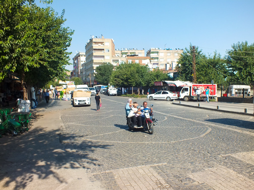
Diyarbakir is a bustling city in the southeastern part of Turkey. Located about 80 kilometers north of the Syrian border, it is the capital of Diyarbakir province and the unofficial capital of Turkish Kurdistan. As you might imagine that doesn't make it the safest place to be right now, although when I went the Kurdish PKK still had a truce with the Turkish government and Daesh had yet to execute any (proven) attacks on Turkish soil. I got in and out just in time too. Nine days after I left the city a Daesh suicide bomber killed 32 youth activists in Suruç (in Şanlıurfa province about 200 km to the west) and shortly after that the PKK murdered three policemen in Diyarbakir in revenge. Now the entire region seems poised to begin a new wave of violence as Turkey takes advantage of the chaos to their south to crack down on their Kurdish problem, all in the name of fighting extremism. Yay.

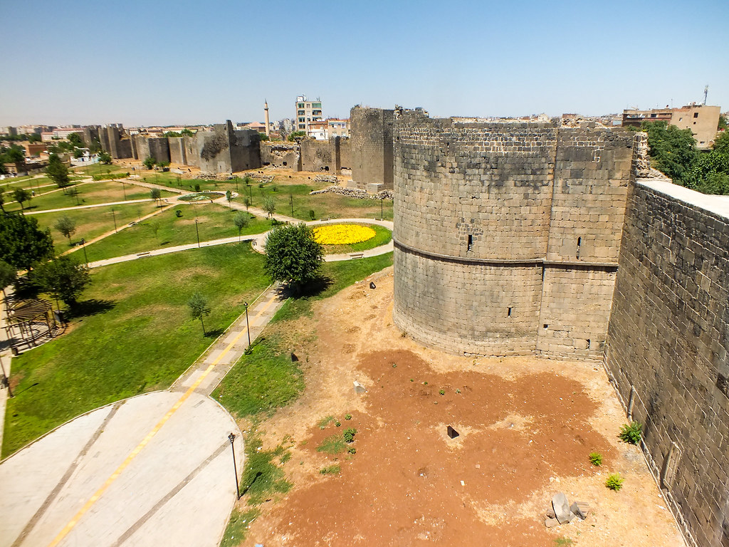
So what made Diyarbakir worth the risk? The old city of Diyarbakir contains a nearly complete set of circuit walls that have survived with few modifications from the late Roman period. More impressive considering this fact is the city's classical antecedents. Once upon a time it was the city of Amida (even today the city is often called Amed in Kurdish). The capital of the province of Mesopotamia, this city produced many important figures but is most famous for undergoing two well-recorded sieges during late antiquity. These sieges are so well recorded in fact that in conjunction with the surviving city walls it is possible to actually identify many of the features in them. For that reason what follows will be a description of the sieges themselves as illustrated by the surviving remains. Due to space constraints this section will only cover the first siege under Constantius and Shapur II while the second will cover the siege under Anastasius and Kavad.

Tuesday, September 18, 2012

Hadrian's Wall, Part VIII (South of the Wall)

Hadrian's Wall wasn't just maintained by the forts on the wall. There were a large number of forts to the south keeping it supplied and ferrying troops where needed. The majority of these are not usually seen on a Wall trip since they are located several miles away from the path and need a full day trip to reach them. Some are ones I haven't been to but intend to before my time here is up. I could have listed most of these as separate trips and I visited several at the same time I walked the wall, but it made more sense to split the wall into wall forts, supply forts, and forts north of the wall. Some of these are linked to days on the wall since they are so close and the journey was the same. For example, we stayed the night in Corbridge yet it is listed separately here. So you can follow the links to see what else is around in that area and what we did for the rest of the day.

Thursday, September 13, 2012

Hadrian's Wall, Part III (Corbridge to Chesters)

Our third day on the wall went much more smoothly than our second. It wasn't nearly as hard (or rather it shouldn't have been) and we were mostly walking through towns along the road. We were quite drained from the previous day though, and our 'easy' trip became quite strenuous as we yet again arrived late to our stopping point. A key thing to remember when doing this section is that while Corbridge and Hexham may be only a couple miles south of the wall those miles are straight uphill. It isn't as easy as it looks. Had we known then what we do now we'd probably have just grabbed the AD123 bus from Hexham up to Wall or Corbridge and then continued from there.

Wednesday, September 12, 2012

Hadrian's Wall, Part II (Newcastle to Corbridge)

 
 Intro
Having spent our first day wandering around Newcastle and getting the train everywhere we finally set off on the actual hike. Our plan today was to get to Corbridge where we had a bed & breakfast reserved for the night. I looked it up on Google Maps and it said that the entire journey would cover about fifteen miles, a long but not impossible stretch. Since there was basically nothing to see for this part of the journey (and certainly no stretches of wall) this didn't seem like a bad idea at the time. Do the serious walking on the days when there were few places to stop at and save the slow days for areas where there was a lot to see. There were only two problems. First, the distance calculation was based on road miles in a direct line to our destination. Google Maps doesn't include walking paths in its directions. I figured that the actual distance would be less than the road miles since the path could cut corners which roads would have to circle around. Boy was I wrong. The trail heads along the river for a while, but then it goes sharply north up through Heddon and then keeps going along a north-westerly direction whereas Corbridge is right on the river about two miles south of the wall. So our strenuous fifteen mile hike turned into a draining twenty mile slog that took up the entirety of the day. Second, I didn't factor in the terrain. Google Maps doesn't show the terrain and while Google Earth does it's very hard to get an idea from it of just how steep it really is. The hills weren't too bad (at least today) but once the trail goes off road all time calculations get thrown off. I'm used to hiking wilderness trails or along roads, not cutting across fields and climbing over fences. Progress is slow and painful, and it doesn't help when you're tired from having walked ten miles already and then up a steep hill. By the time we arrived at Corbridge at about 9 PM we were too tired to move.

Tuesday, September 11, 2012

Hadrian's Wall, Part I (South Shields to Newcastle)

 Because this is such a large area this section will be split into nine parts, one for each of the seven days of the trip plus an extra two for the miscellaneous forts surrounding the wall. The majority of this walk (from Newcastle to Birdoswald) was done at the same time but I've included bits from other walks in the place where they most logically fit in. This trip will only deal with the wall itself and the forts that lay upon it. There are several supply forts, closely connected to the wall, that we visited but they will be listed in parts eight and nine. I'll mention them when they come up but click on the link for more detail.

Monday, June 27, 2011

Iolkos

I have little to say about this place. Iolkos was the home of Jason according to legend. There is a Mycenaean citadel there but I actually managed to miss it. We only stopped here because it was more or less on the way. Unfortunately due to the strikes we were unable to get in. The entire site was fenced off. So I, uh, hopped the fence. I'm a little embarrassed about that but I was really fed up with governmental stupidity by this point. They just aren't capable of running these priceless sites by themselves. The popular and rich ones or the ones located by prosperous towns are the only exceptions. It makes me sympathize with the British when they roamed through these lands taking all the priceless artifacts back to display in London. We kept joking that the British members of the group were sizing up the sites to see what artifacts to take when they entire country inevitably dissolved in riots.

Sunday, June 26, 2011

Gla

 
Gla is a Mycenaean citadel in Boeotia. It's about twenty miles or so from Thebes and was where the villagers used to go when they were under attack. The citadel doesn't have a palace or any major buildings since it was intended as a temporary refuge. They think. This entire area used to be swamp which made it harder for any armies to campaign there. This is a pretty cool site since nobody knows it exists. if you're looking fro aa genuinely untouched site this is the one.

Friday, June 24, 2011

Corinth

 
There isn't very much at Corinth worth seeing. The Romans wiped this place clean in 146 BC and they did a pretty thorough job of it. The city was rebuilt later but I believe it was in a different location since I didn't see any Roman or Byzantine remains here. Certainly by the time of the fourth crusade the Acrocorinth (the big cliffs there in the background) was the main stronghold in the area.

Wednesday, June 22, 2011

Pylos

COMING SOON
 
Pylos is a beautiful place. The area just looks quintessentially Greek. The bay itself has a beautiful beach, the surrounding area is filled with history, and the main roads are little more than paved dirt paths. Nestor's Palace is located on one of the hills just over the umbrellas on the left.

Monday, June 6, 2011

Hadrian's Wall

 
Hadrian's Wall is one of the best known Roman sites in Britain. The wall stretches from the west coast by Carlisle to the east coast at Newcastle. Along the way it runs over cliffs and valleys and defines the terrain. There are also a number of forts along the way which housed the soldiers who guarded the wall. There is a ten mile stretch in the middle that contains the best-preserved sections of wall as well as several of the better forts. This is really the section to do and the only way to really see it is to walk it. Naturally that meant we drove.

Sunday, June 5, 2011

St. Michael's Mount

COMING SOON

St. Michael's Mount is a little castle set on an island that is only accessible from a small road when the tide is out. It is very similar to Mont Saint-Michel which I kept confusing it with the whole trip, except that Saint Michael's Mount is much smaller and doesn't have a big town on it. The main town is that of Marazion located on the other side of the bridge. St. Michael's Mount is also closed on Saturday which is what screwed our schedule up. We had originally planned to go to Saint Michael's Mount on Saturday and Tintagel on Sunday but with the positions reversed we had to change our plans. If you're going to Saint Michael's Mount it is important to check the tides. If the tide is in there is no way of accessing the island unless you want to hire a boat.

Saturday, June 4, 2011

Tintagel

Tintagel was fun. We left Arundel at 12:30ish and Tintagel closed at 5:30. We didn't start out rushed but as we got closer we realized that we were going to be pushing it. England is full of speed cameras which means that speeding just isn't worth it. Unlike cops Speed Cameras are always there and they don't skip cars just because other people are speeding. There's also no way to argue your way out of a speeding ticket since there is visual evidence of your identity when the camera takes a picture. Worst are the average speed zones where they average your speed for the entire section. These are mostly construction zones and they are annoying. I'm quite glad I'll never have to deal with them. The point is that it doesn't pay to speed. If a journey takes five hours it takes five hours.

Tintagel is a place filled with myth and mystery. Connected from an early date with King Arthur it has a strong mythical pedigree. This is the supposed site of his birth and where Uther Pendragon conceived him upon Igraine by appearing as her murdered husband Gorlois through the aid of Merlin. It is basically an island connected to the mainland via a thin spit of land. The island itself is all cliff and cannot be approached on any side. It is basically the perfect defensive position except that it is impossible to sneak supplies in. The cliffs are just as deadly for friends as for enemies.


Arundel

On our way to Tintagel we stopped over for the night near Arundel. Arundel Castle is the best preserved in the country and is still the residence of the Duke of Norfolk.