Hadrian's Wall is one of the best known Roman sites in Britain. The wall stretches from the west coast by Carlisle to the east coast at Newcastle. Along the way it runs over cliffs and valleys and defines the terrain. There are also a number of forts along the way which housed the soldiers who guarded the wall. There is a ten mile stretch in the middle that contains the best-preserved sections of wall as well as several of the better forts. This is really the section to do and the only way to really see it is to walk it. Naturally that meant we drove.
Our first stop was the famous fortress of Vindolanda. This location is best known for its collection of letters written by local soldiers and recording the everyday running of the fort. Hundreds of these have been recovered since the '70s and are an exciting look at how the Romans in Britain really lived. It is also the best-preserved and largest surviving fort in England. Vindolanda wasn't directly on the wall since it was a supply fort. It was the main fort for this region and was where the commander was housed. It wasn't the main fort, that was in Carlisle and has been completely built over. Still, it was a large one and much of the foundations are still intact.

The starting point if you're coming from the East is the museum. This building houses the museum, a gift shop, restaurant and facilities for the archaeologists working at the site. The museum is bigger than it looks since much of it is underground. This site is part of the Vindolanda Trust which runs this area as well as the Roman Army Museum. If you plan to see both then it pays to get a group ticket. It costs about ₤11.
After you exit the museum you come to a small park. I found it rather tacky and I suspect that it was built during the 19th Century. The recreated Roman temple and houses are cheap-looking and don't seem Roman. The dummies inside are scary looking and don't look Roman. They look rather more like Georgian women in dress and appearance. To get past the park you cross over the bridge and walk up the hill to the archaeological site.
The site laid out in such a way that you can see the outlines where the buildings were. The remains of the buildings are a few feet high and it is easy to imagine their size and position.
The officers were lucky enough to have heated rooms. These little stones would have held up the floor and there would have been a fire running underneath.
Each building had a plaque set up in front of it usually with pictures and a brief description of the building's function. They were translated into French, German, and Latin which I found very cool.
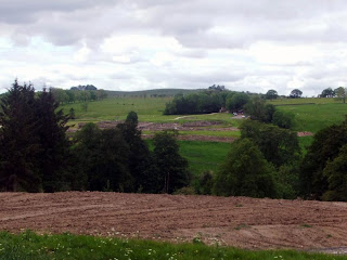
When we went there archaeologists were working on the north end of the site. There were a lot of them there and the whole area was blocked off. One of the people in charge of the dig was explaining to the visitors what they were doing and various other details about the site.


On the south part of the site is a reconstructed section of the camp wall. One side is made of wood while the other is made of stone. This probably represents the site at different stages in its use. For many years the site had only a wooden wall as befits a temporary camp but by the 4th Century the walls were of stone. Despite having his name attached to it Hadrian never built his wall in stone. It was an earth and wood construction designed to keep the Caledonians (Scots) out until something could be done about them. His successor Antoninus Pius built another wall further north called the Antonine Wall which was probably very similar to the original wall of Hadrian. By the time of Septimius Severus 60 years later the Roman frontier had returned to where Hadrian had left it and his wall was strengthened and rebuilt from stone. That's the wall that stands today. For centuries it was actually thought that Severus was the one who built the wall since there was no mention of Hadrian building the wall except in one unreliable source from the 4th Century. It was only in the 19th Century that inscriptions from Hadrian's time were uncovered.


The inside of the tower is pretty basic but seems to look much the way the Romans would have built it. Some towers had room for an office and officer's quarters inside but this one is clearly too small for that.
The wooden tower is much simpler and has a gate underneath it.
The Vindolanda Museum has a great many artifacts from this site including several of the Vindolanda letters. It isn't very big but it has more than it appears to since there is a second floor downstairs. The cafe is also nice and has good coffee and snacks although the pie my friends got was bad and had to be replaced.

The Roman Army Museum is about 7 miles away and is located on another Roman fort. This one hasn't fared as well as Vindolanda and is little but an outline in the field. It was called Magnis and was another of the forts on the wall even though the section of the wall bordering it has been lost due to quarrying. The museum itself is simple and entertaining. Too simple and entertaining in fact. It is designed for families and children and doesn't have much in the way of artifacts. Most everything you see there is a reconstruction of something. They do have a nice film which is in rather bad 3D and features excellent recreations of how some of these forts would have looked when they were still in use. For that alone it may be worth the trip. Those who know how about the Romans and don't want simplistic information are advised to skip this stop and see one of the other sites instead. The museum at Vindolanda is much more in depth. This museum closes at 6.
Housesteads (Vercovicium) is one of the nicest forts on the wall. Located about two miles away from Vindolanda it is well worth the visit. Even if you don't pay for the fort it is located along one of the nicest sections of wall. This is not included on the cost of the Vindolanda ticket and must be paid for separately. It is run by the National Trust and costs about ₤5.50. The parking machine charges ₤3 and only takes ₤1 and ₤2 coins.
Getting up to the fort requires a lot of walking. It is at the top of the hill and there is no other way up. It is located in the middle of sheep fields and you have to watch out for them as you go up. When we went there there was a sign asking us to please stay on the path since it was lambing season. Since the only way to the wall without cutting through the fort seems to be to go off the path we ended up making our own way and trying to avoid sheep.
Once you reach the top you can see the wall. While it is difficult to see from the road from the top it is readily visible. This stretch goes past the fortress walls and continues down the hill.
To the right the wall continues on for miles, but the view is blocked by an inconvenient clump of trees. There are many farmers' walls in the area, many of which look suspiciously like they're built from stones that used to be in the wall. The wall itself is distinctive only by its size and occasionally poor preservation.
On the left the wall goes through a copse of trees. The sides of the wall are covered in dirt and have plants growing from them. It seems like little more than a dirt mound. Once you walk through the trees though you come to one of the best stretches of wall.
This area is very hilly and the wall is built on a cliff making it virtually unscalable.The section of wall is mostly intact and can be clearly seen for miles.
This is a mile castle. There are a great many of these scattered along the wall just about every mile as the name would suggest. These are smaller forts designed for only a few people as opposed to the massive forts that contain hundreds. This mile castle is number 37 and its right near Housesteads.
It would be extremely interesting to know how the system worked. The soldiers in these little forts must have been rotated occasionally but how was it done? Did they do it on a daily basis or were these people here for weeks at a time? Either way these buildings are neat and they tend to be empty and isolated unlike the bigger fortresses which attract people.
My companions didn't want to go far on the wall since they wanted to see the Roman Army Museum so I had to run ahead to get these pictures. I was very out of breath by the time I got back since I must have run at least half a mile up and down hills in about 10 minutes. It was worth it for these views though. As ever there was always a better and more impressive view from the hill just ahead of me.
55° 0'48.02"N, 2°19'48.53"W
Great Chesters is the name for this fort, although why they bothered to give it an English name is beyond me. Aesica is what the Romans called it and it is now a part of some guy's farm. The outer wall is still there but the interior structure is gone. If you walk the wall it might be worth a brief examination but other than that there's not much to see.
This spot is called the sycamore gap. The reasons are obvious. It is one of the most photographed sections of the wall because it is such a distinctive site.
55° 0'12.47"N, 2°22'25.86"W
This is called the Angel of the North. It's a big statue located off the A1 just south of Newcastle. It's kinda ugly but impressive.


No comments:
Post a Comment